CAMEL is the Center for Ancient Middle Eastern Landscapes at the Institute for the Study of Ancient Cultures. We engage in research and mapping of landscapes in West Asia, Central Asia, and North Africa.
News

A3RD Workshop at the John Boyer Center (Paris)
From March 16th to 23rd, 2025, the A3RD project team from the University of Chicago’s CAMEL Lab held a week-long workshop at the University’s John W. Boyer Center in Paris. Funded by a Faculty Grant from the University of Chicago’s International Institute of Research...

A3RD Workshop Series on Deep Learning in Archaeology
As part of its commitment to pioneering innovation through collaboration, CAMEL hosted an intensive series of workshops and hackathons from winter through spring 2024 to support the goals of the AI-Assisted Archaeological Remains Detection (A3RD) project. Designed to...
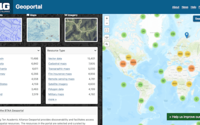
Camel collections now accessible on the BTAA geoportal
Since 2005 the Institute for the Study of Ancient Cultures (ISAC) provides public access to information about the diverse research and object-based collections by means of their integrated database (idb). As part of this renowned collection, Camel Lab has published...